
Appendix #S1: New Amsterdam circa 1664

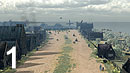
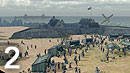
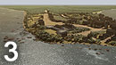


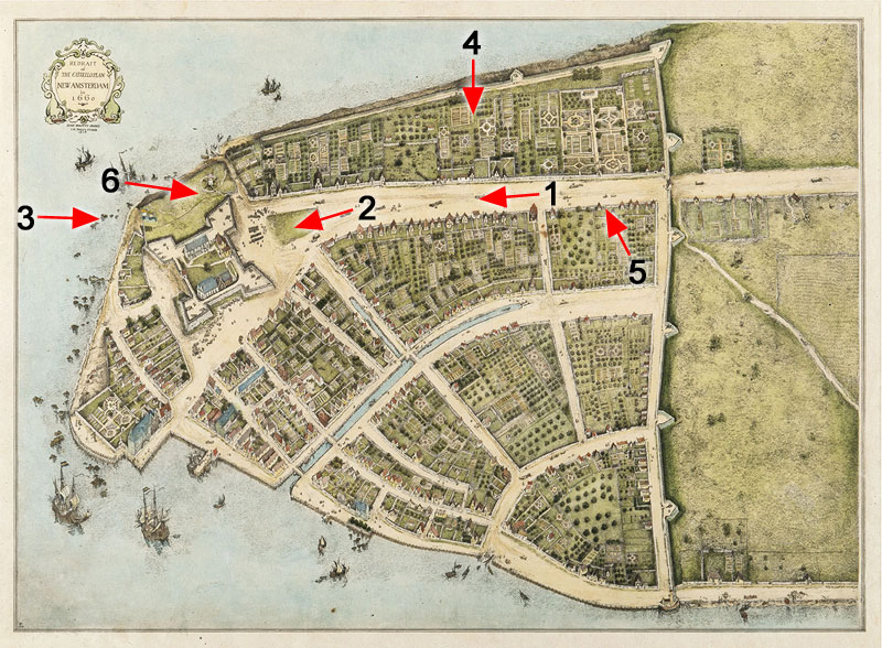
Map Overview: The 3D renderings below are "camera" views of New Amsterdam about 1660 looking down Broadway and near the Fort. The arrows on the Castello Map above identify the locations of each perspective. The 3D computer model of New Amsterdam was produced by Devan Calabrez in collaboration with Bruce Twickler based on the Stokes Map Redraft shown here and the 3D topographical data from Eric Sanderson of the Mannahatta Project.