
Appendix #15: The Fires of the "Revolt" of 1741
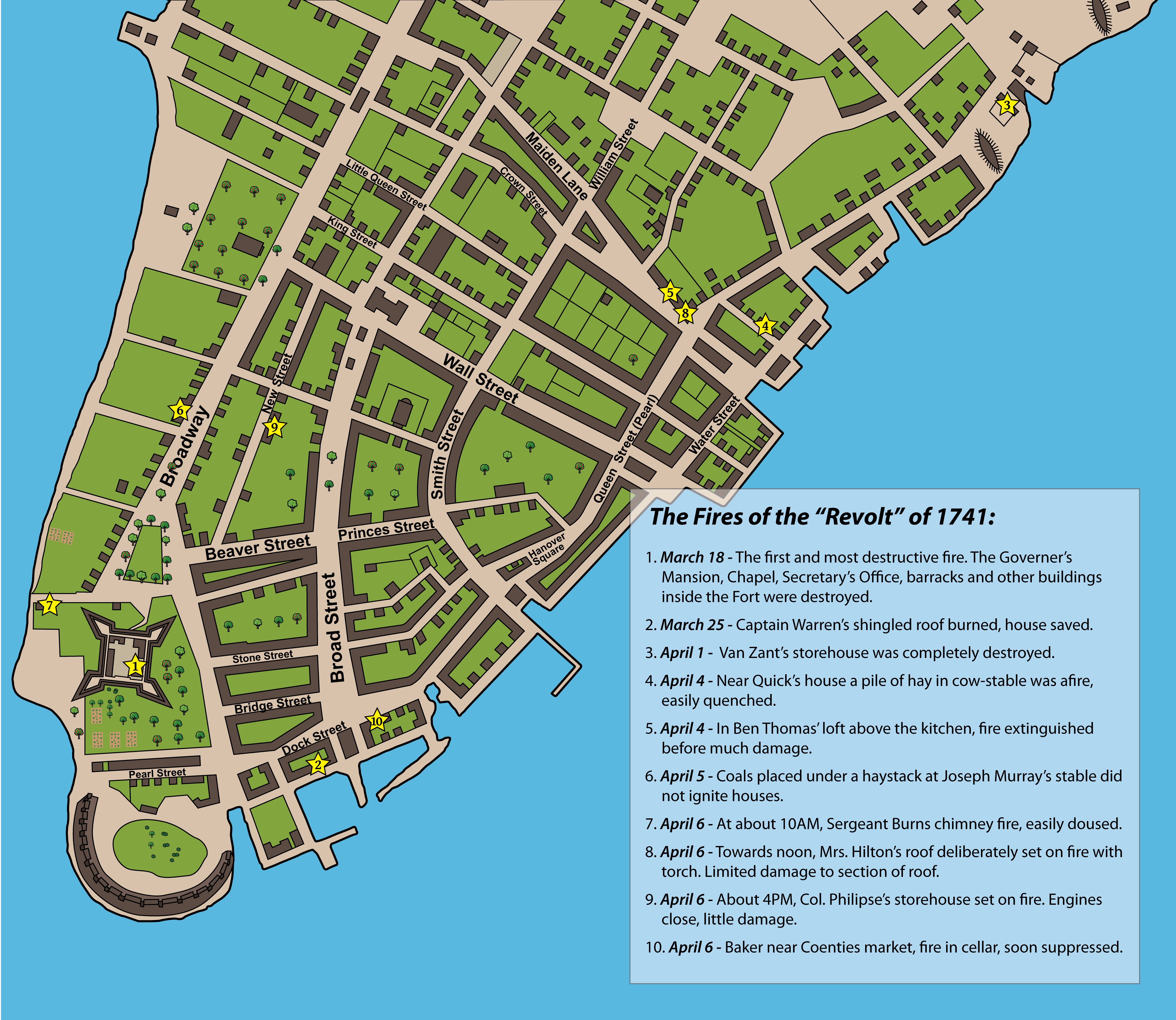
Illustration 15: Map of the Fires of 1741
The fires started mid-March in the fort. It would be the worst fire the city had experienced since its founding. It destroyed the governor's house, the chapel, the barracks, anything that could burn inside the walls of the fort. No one suspected it would be just the beginning. In the next weeks there were nine more fires. It was not a "real" slave revolt like the one in 1712... maybe a dozen disaffected slaves. But, citizens were panicked and no one second-guessed the harsh decisions of the tribunal led by Daniel Horsmanden that killed or banished over one hundred slaves.
References:
Map: Based on the David Grim pen and ink drawing of 1813 A Plan of the City and Environs of New York as they were in the years 1742, 1743 and 1744 at New-York Historical Society.
See online copy at: Lionel Pincus and Princess Firyal Map Division, The New York Public Library. The New York Public Library Digital Collections.
Fires and locations: From Daniel Horsmanden's descriptions in A Journal of the Proceedings in the Detection of the Conspiracy Formed by Some White People, in Conjunction with Negro and other Slaves, for Burning the City of New-York in America, and Murdering the Inhabitants. (John Clarke, London, Royal Exchange, Cornhill, 1747). (Reprint of original); and from Jill Lepore's "Data" on her Harvard website which directs to data referenced in her book New York Burning: Liberty, Slavery, and Conspiracy in Eighteenth-Century Manhattan