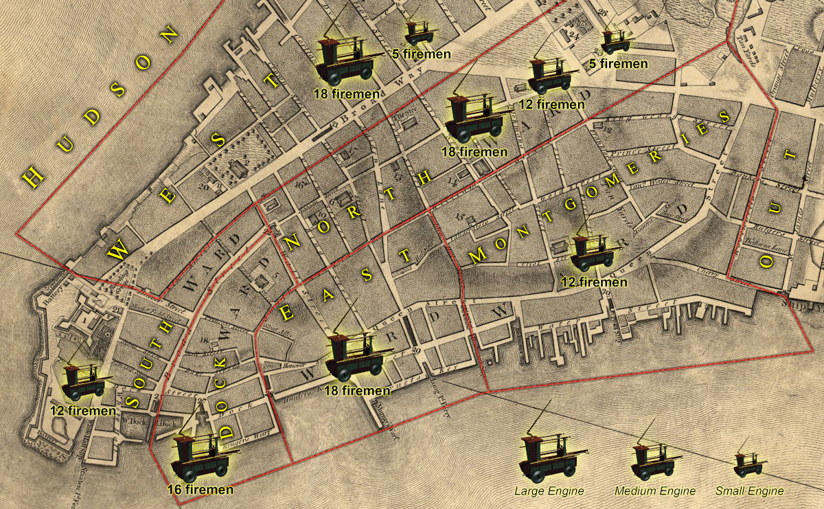
Appendix #17: Map of Wards (Engines & Firemen) circa 1769

Illustration 17: Map of Wards (Engines & Firemen) circa 1769
This detail of the Ratzen Plan from 1767 illustrates the boundaries of the wards with overlays of the complement of engines and firemen assigned to each ward in 1769. The wards here are generally larger than the 17th century wards (see Illustration 8) expanding north. South and Dock Wards extend to Wall Street. North Ward extends north of Wall Street and has as its western border with the West Ward on a line projected north from New Street. Montgomery(ies) Ward then had a definitive boundary on its north with the Out Ward.
For the first time in 1769 the fire department assigned firemen to specific engines rather than to a ward. The engine companies thus formed, each managed by a foreman, became the essential components of a system that would endure almost a century into the mid-1800s. Jacobus Stoutenburgh was the Engineer (fire chief) who presided over this new and expanded system (increased from 72 to 116 firemen) with the help of two Assistants who were both veteran firefighters. All of the lower six wards, south of the pond called Fresh Water, had at least one engine. Out Ward received an engine and fire company in 1772 when the department expanded from nine to eleven companies.
References: MCCCNY Vol vii pages 144-146 February 1, 1769; Detail of Ratzen Map from The Miriam and Ira D. Wallach Division of Art, Prints and Photographs: Print Collection, The New York Public Library. (1776).To his excellency Sr. Henry Moore... this plan of the city of New York... Retrieved from https://digitalcollections.nypl.org/items
